


North America Water Vapor Patterns
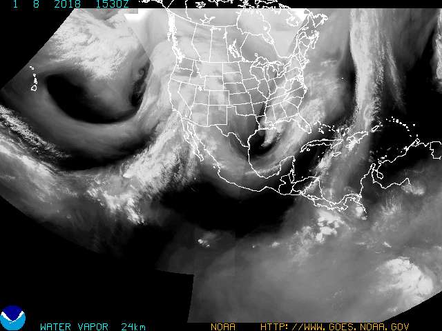
Weather and storms across the world constantly affect our daily lives. As technology has improved, scientists have placed satellites in orbit around the world to monitor changing weather patterns. In this example, the Geostationary Operational Environmental Satellites (GOES) operated by NOAA reflect different ways of viewing the Earth and its atmosphere. GOES views include visible, infrared, water vapor channel (seen here), and other views to monitor weather systems around North America. This image is excellent to view how water vapor in constantly swirling around the globe.
During the summer months you can see the hurricanes forming off the east coast of Florida. The tropical storms and hurricanes appear as large swirls of white. You will also be able to see large storms forming off the west coast of Mexico in the Pacific Ocean.
This image displays the water vapor channel data delivered from GOES satellites orbiting the Earth. The image is updated every three hours. You may view the page sponsored by National Oceanic and Atmospheric Administration (NOAA) at http://www.goes.noaa.gov/goesfull.html.
Link: Geostationary Satellite Server (NOAA)
- Mt. St. Helens
- Kīlauea Volcano
- Quakes (CA)
- Quakes (Global)
- Water Vapor
- Cloud Temperature
- Streamflow (U.S.)
- The Sun
- All Earth Monitors
- More Topics

©copyright 1997-2015 Andrew Rader Studios, All rights reserved.
Current Page: Geography4Kids.com | Physical Geography | Earth Monitors | Water Vapor Patterns